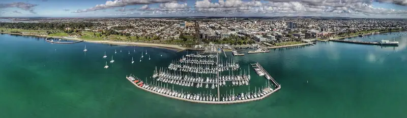
Geelong sits on the south shore of Corio Bay. The waterfront runs along the bay from Rippleside to Eastern Beach, the CBD lies directly behind it, and the station is on its west edge. The Bellarine Peninsula spreads east, Torquay and the Surf Coast are about 25 minutes south, and Melbourne is about 75 km north-east.
Geelong sits on the south shore of Corio Bay, the western arm of Port Phillip. The waterfront follows the bay from Rippleside in the north-west to Eastern Beach and Limeburners Point in the east. The CBD is the grid of streets directly behind it, with Geelong station on its western edge. Go east and you reach the Bellarine Peninsula; go south and you reach Torquay and the Surf Coast; head north-east up the M1 and you reach Melbourne, about 75 km away.
The map on this page plots 40 places from our research, each with its source. Below it, a plain list gives the same points for anyone who prefers text.
How central Geelong is laid out
Picture a strip of bay with the city stacked behind it. Almost everything a visitor wants in town is within about a kilometre of the Carousel pavilion at the foot of Cunningham Pier, which makes it a good place to measure from.
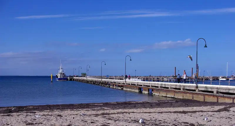
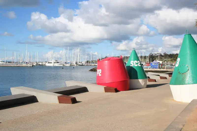
- The waterfront. Cunningham Pier, Steampacket Gardens and the Carousel are in the middle. West of the pier are Western Beach, the Nyaal Banyul convention centre and the Crowne Plaza. East, the path runs past the Novotel to Eastern Beach. The painted Baywalk Bollards are spread along the whole stretch; our bollards guide maps the trail.
- The CBD. Directly south of the waterfront. The National Wool Museum is on the edge nearest the bay. A short walk inland are the cultural blocks around Little Malop St: Geelong Gallery, the library and heritage centre, and the arts centre, with the visitor centre at City Hall on Gheringhap St.
- The station. On the western edge of the CBD, about 10 minutes’ walk from the Carousel.
- Eastern Park. East of the CBD, holding the Botanic Gardens and the golf course, beside Eastern Beach.
- Kardinia Park. South of the CBD, home to GMHBA Stadium. South Geelong station is about 450 m from the ground.
- North Geelong. Along the bay to the north is the working port at Corio Quay, where the Spirit of Tasmania leaves for Devonport.
Distances from the waterfront
Straight-line distance from the ferry stop beside the Carousel, with our walking estimate (distance x 1.3 at 5 km/h). Checked October 2026.
| Place |
Direction |
Distance |
Walk, about |
| Cunningham Pier |
North |
0.1 km |
2 min |
| Steampacket Gardens |
Beside the Carousel |
0.2 km |
3 min |
| National Wool Museum |
South-west |
0.3 km |
4 min |
| Crowne Plaza Geelong |
West |
0.3 km |
4 min |
| Westfield Geelong car park |
South |
0.4 km |
6 min |
| Visitor centre, City Hall |
South-west |
0.6 km |
10 min |
| Geelong Gallery |
South-west |
0.6 km |
10 min |
| Geelong station |
West |
0.6 km |
10 min |
| Geelong Arts Centre |
South-west |
0.7 km |
11 min |
| Eastern Beach swimming enclosure |
East |
1.1 km |
16 min |
| Geelong Botanic Gardens |
South-east |
1.6 km |
24 min |
| GMHBA Stadium |
South |
1.8 km |
28 min |
| Rippleside Park (bollard trail, west end) |
North-west |
1.9 km |
30 min |
| Limeburners Point (bollard trail, east end) |
East |
2.0 km |
31 min |
| Spirit of Tasmania terminal |
North |
4.1 km |
Drive or taxi |
Geelong area map: drive times
Road distances and free-flow driving times from central Geelong, from the OpenStreetMap routing engine. Add 10 to 20% for traffic, more on summer weekends.
| Place |
Direction |
Road distance |
Drive, about |
| Serendip Sanctuary |
North |
20 km |
25 min |
| Avalon Airport |
North-east |
25 km |
30 min |
| You Yangs |
North |
28 km |
35 min |
| Torquay |
South |
22 km |
25 min |
| Barwon Heads |
South-east |
22 km |
25 min |
| Ocean Grove |
South-east |
23 km |
25 min |
| Bells Beach |
South |
29 km |
35 min |
| Point Lonsdale |
South-east |
29 km |
30 min |
| Portarlington |
East |
31 km |
30 min |
| Queenscliff |
South-east |
31 km |
35 min |
| Anglesea |
South-west |
36 km |
40 min |
| Lorne |
South-west |
66 km |
1 h 10 min |
| Melbourne CBD |
North-east |
75 km |
1 h 5 min |
| Apollo Bay |
South-west |
120 km |
1 h 50 min |
| Twelve Apostles, inland via Colac |
West |
150 km |
2 h 25 min |
Bellarine map
The Bellarine Peninsula is the thumb of land east of Geelong that closes off Port Phillip from the west. Its bay side faces Melbourne: Portarlington, with its pier and weekend ferry, and St Leonards. The ocean side runs from Barwon Heads and Ocean Grove to Point Lonsdale and Queenscliff, where the Searoad ferry crosses to Sorrento in about 40 minutes. The Bellarine Rail Trail follows the old railway from South Geelong to Queenscliff.
The whole peninsula fits in a day by car. Buses do reach it: route 56 runs to Queenscliff via Ocean Grove and Point Lonsdale, route 60 to Portarlington and St Leonards, route 55 to Ocean Grove via Barwon Heads. Regional bus fares are half price until 1 January 2027.
South to the Surf Coast
Torquay is 22 km south, and that is where the Great Ocean Road officially begins. From there it runs about 240 km west past Anglesea, Lorne and Apollo Bay. Our Great Ocean Road map covers the coast in detail. The fastest road from Geelong to the Twelve Apostles goes inland via Colac (about 150 km); the coast road via Apollo Bay is about 205 km and three hours or more.
Two places hand out maps and advice. The main Geelong Visitor Information Centre is in City Hall at 30 Gheringhap St, open 10 am to 4 pm daily; it moved there from the National Wool Museum in late 2023. A second point at the Carousel covers the waterfront. The phone number is 1800 755 611. This site is independent and has no link to either.
A note on the pins. The bollard trail ends, the ferry stop, the Busport and Western Beach car parks are approximate, and town pins for places like Torquay or Lorne mark the town label, not an exact centre. Close enough to plan a day, not to navigate a car park.
Getting around
Inside town, walk. For the wider map, a car is simplest. Without one, take the train from Melbourne, use bus 53 to Torquay, and lean on the Bellarine buses or the weekend ferries. Where you sleep changes the walking times above, so our where to stay in Geelong guide lists them hotel by hotel.