Melbourne: Great Ocean Road, 12 Apostles & Rainforest Tour
13 hours
Breaks the drive at Serendip Sanctuary near Lara for a wildlife stop before Anglesea, the Memorial Arch, Apollo Bay, the Otways and the Twelve Apostles.
fromA$165
Check availability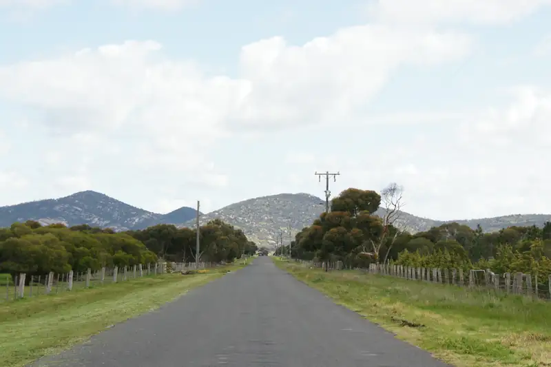
The You Yangs are a granite range rising from the plains about 35 minutes' drive north of Geelong, inside a free Parks Victoria regional park. The Flinders Peak walk climbs 450 steps to the top at 319 m for views of Geelong and Melbourne. The park also has 50 km of mountain bike trails and the Bunjil geoglyph.
The You Yangs are a low granite range about 35 minutes’ drive north of Geelong, protected in You Yangs Regional Park. Entry is free. The main walk climbs about 450 steps from the Turntable car park to Flinders Peak, 319 m high, with views to Geelong and Melbourne. There are also more than 50 km of mountain bike trails, picnic grounds and the Bunjil geoglyph.
Wikipedia gives the peak as 343 m, but the regional tourism body and most walking guides use 319 m.
The park office is at 5 Branch Road, Little River. From central Geelong it’s about 28 km to the Big Rock area, around 35 minutes by car. From Melbourne it’s about 67 km and an hour, and Parks Victoria pitches it as “just an hour away”. There’s no public transport into the park.
| What | Detail |
|---|---|
| Entry | Free |
| Hours | 7 am to 8 pm daily (Parks Victoria) |
| Main walking car park | Turntable car park, for Flinders Peak |
| Overflow | Lower Picnic Area car park |
| Dogs | Allowed on a lead; pick up after them |
| Fires | In fireplaces only; no collecting firewood |
| Phone | Parks Victoria, 13 1963 |
Checked October 2026. Visit Geelong and the Bellarine’s 2026 guide gives earlier closing times (5 pm outside daylight saving, 6 pm in daylight saving), so don’t plan a sunset walk without checking the gate times first.
Install the VicEmergency app for bushfire alerts and check Parks Victoria for closures before you go, as the regional tourism guide advises.
This is the walk most people come for. It starts at the Turntable car park and climbs a single track of steps to the summit.
Matthew Flinders climbed the peak on 1 May 1802 with three of his men and called it Station Peak. It was renamed Flinders Peak in 1912. From the top you can see out to both Geelong and Melbourne.
Take water and wear shoes with grip; the steps are steep in places. If the Turntable car park is full, Parks Victoria suggests heading to Big Rock instead.
| Walk | Length | Time | Notes |
|---|---|---|---|
| Big Rock | 100 m from its car park | A few minutes | Easy; view towards Geelong |
| Big Rock loop from the park office | 3 km | Not given | Return the same way |
| East-West Walk | 4.5 km | About 2 hours | Challenging; from the Turntable car park |
| Branding Yard Trail | 5 km | About 2.5 hours return | Mild; wildlife and spring wildflowers |
| Northern Range Walk | 3.5 km one way | About 1 hour | Steep in places |
Distances and times from Visit Geelong and the Bellarine’s January 2026 guide.
Volunteers run free guided walks, booked through Eventbrite.
Bunjil is a creator spirit in Aboriginal tradition, shown here as a wedge-tailed eagle. Artist Andrew Rogers laid out the figure in rock for the Melbourne 2006 Commonwealth Games, and Wikipedia says it was unveiled in March 2006 to honour the local Wathaurong (Wadawurrung) people. It has a wingspan of 100 m and used 1,500 tonnes of rock. You see it from the ground at the Bunjil Geoglyph day visitor area on the Branding Yard Trail.
The park has more than 50 km of mountain bike trails, designed with Parks Victoria, You Yangs MTB and the Geelong Mountain Bike Club.
All trails are signposted with direction and grade.
More than 200 bird species have been recorded in the park, and about 30 orchid species, including the endangered brittle greenhood. Koalas, kangaroos, wallabies, echidnas and emus are all seen; the quieter Branding Yard Trail is the best bet.
The Lower Picnic Ground has gas barbecues, shelters, tables and toilets under big red gums, and suits groups. Parks Victoria lists nine picnic areas across the park.
Serendip Sanctuary is a free Parks Victoria wetland reserve at 100 Windermere Road, Lara, at the foot of the You Yangs and 22 km north of Geelong. Parks Victoria says its wide, flat paths suit manual and electric wheelchairs.
Serendip and Flinders Peak fit in the same morning.
West of the You Yangs, the Brisbane Ranges National Park is about 80 km from Melbourne and roughly 35 km from Geelong. Parks Victoria calls it the state’s richest wildflower habitat, so spring is the season to go.
The Anakie Gorge walk is the easy family option, about 3 km one way, with wallabies and a resident koala. Boar Gully at the northern end has a campground that must be booked online, and it’s the trailhead for the three-day Burchell Trail. Dogs are not allowed anywhere in the national park, and fires are banned on the gorge walk.
Fairy Park is a few kilometres from Anakie Gorge, which makes a good family day: storybook scenes in the morning, a gorge walk after lunch.
From Geelong, a half-day loop works well: Serendip Sanctuary when it opens at 8 am, Flinders Peak before the heat, then lunch at the Lower Picnic Ground. For a gentler river walk closer to town, try Buckley Falls. The Geelong day trip guide has more ideas for a day out from the city.
13 hours
Breaks the drive at Serendip Sanctuary near Lara for a wildlife stop before Anglesea, the Memorial Arch, Apollo Bay, the Otways and the Twelve Apostles.
fromA$165
Check availabilityPrices and ratings were taken from GetYourGuide and can change. Booking through these links supports this site at no extra cost to you.
Updated
The Flinders Peak walk is about 3.2 km return from the Turntable car park, with about 450 steps and a climb of around 200 m. Parks Victoria calls it a challenging walk, and some gradients are steep, so wear proper shoes and take water. Dogs are allowed on a lead. The summit is the highest point in the park, with views to both Geelong and Melbourne.
Visit Geelong and the Bellarine, the regional tourism body, gives Flinders Peak as 319 m above sea level, and most walking guides agree. Wikipedia currently gives 343 m. Either way it's the highest point of the You Yangs, and the walk from the Turntable car park climbs about 200 m of that, so you start well above the plains.
By road the You Yangs are about 28 km from central Geelong, around 35 minutes to the Big Rock area. From central Melbourne it's about 67 km and roughly an hour. There's no public transport into the park, so you need a car, a bike or a tour.
Yes. Parks Victoria says the park has more than 50 km of mountain bike trails in two areas. The Kurrajong Plantation area has about 20 km in three loops, flatter and suited to families and beginners. The Stockyards area in the north has flowing single track, steep technical sections and three downhill tracks. All trails are signposted with directions and grades.
It's a huge rock artwork of Bunjil, a creator spirit in Aboriginal tradition, shown as a wedge-tailed eagle. Artist Andrew Rogers made it for the Melbourne 2006 Commonwealth Games. Wikipedia gives a wingspan of 100 m and 1,500 tonnes of rock. You see it from the ground at the Bunjil Geoglyph day visitor area, off the Branding Yard Trail.
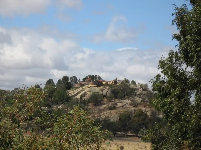
Fairy Park is a fairytale theme park in Anakie, about 33 km north-west of Geelong, open since 1959.
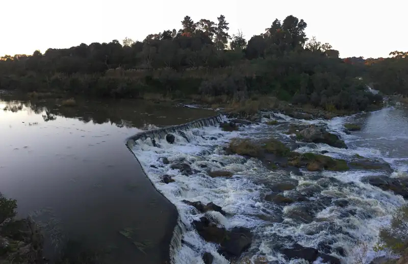
Buckley Falls is a small waterfall on the Barwon River at Highton, about 6 km west of central Geelong.
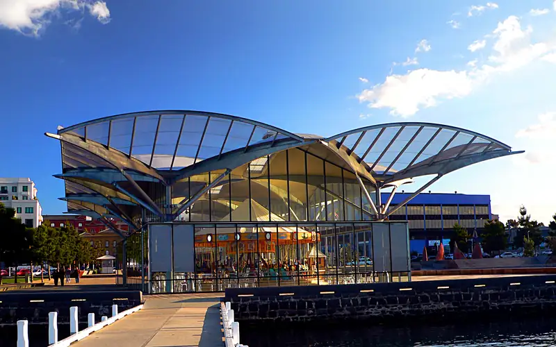
Geelong is easy with children.
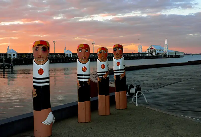
A day trip to Geelong from Melbourne works best by train: V/Line takes about an hour from Southern Cross and runs every 20 minutes.